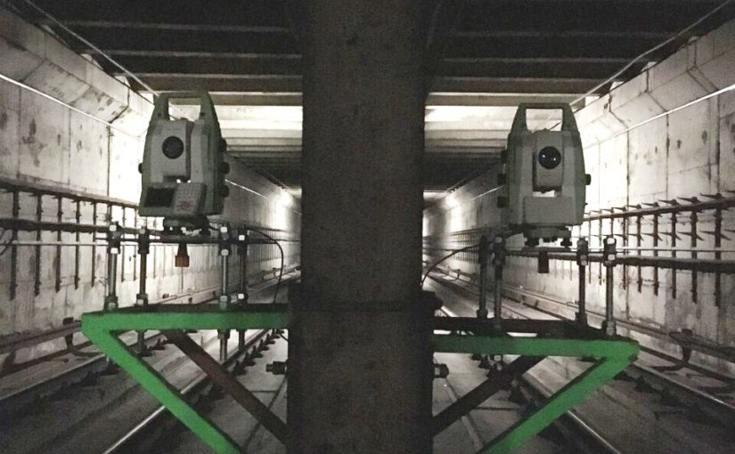


Topographic monitoring
Topographic monitoring is well integrated with geotechnical-structural one, both in the geological field, for study of the evolutionary trend of landslides, and in the civil engineering sector, in order to perceive and control deformations that could develop in particularly sensitive structures or simply to monitor their behavior in relation to their interaction with soil, environment and use.
Img designs and manages monitoring systems in many areas of intervention:
• Tunnels and underground works
• Landscaped areas
• Bridges and viaducts
• Railway lines
• Small and medium construction
• Historical and monumental buildings
• Bulkheads and support walls
providing services of:
• Installation of continuous monitoring systems in real time
• High precision leveling
• Altimetric plan monitoring with total station and high precision optical targets
• Altimetric plan monitoring by GPS
• Convergence measures
• Processing and presentation of measures
Img has always successfully managed the most critical contexts that require complex monitoring systems through remote control of acquired data enabling access to results at any time and everywhere by carefully managing critical thresholds for the various monitored structures.